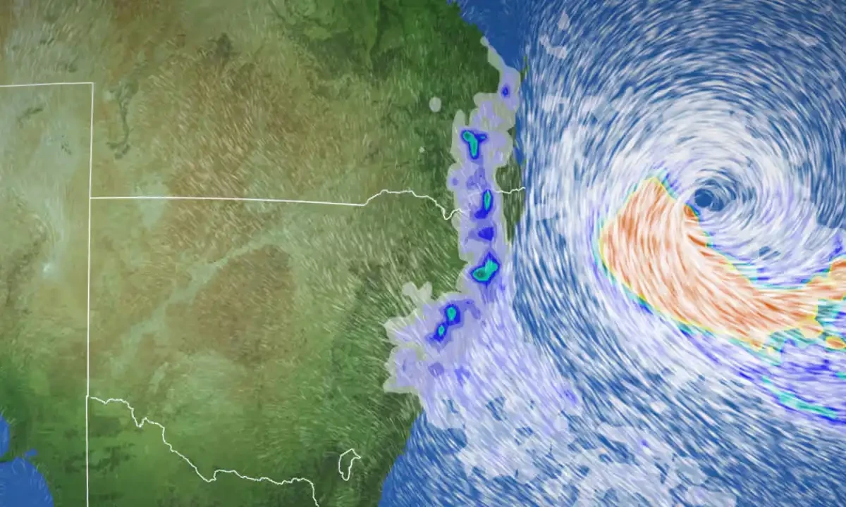
Tropical Cyclone Alfred turns towards Queensland
Tropical Cyclone Alfred has reversed direction and was approaching the south-east Queensland coast as a category 2 storm, The Guardian reported.
Alfred is expected to maintain its strength until it makes landfall late Thursday or early Friday, according to the Bureau of Meteorology.
Residents from the Sunshine Coast to the Gold Coast and northern NSW, totaling around 4 million people, were reported to be preparing for the storm, leading to an unprecedented demand for sandbags.
The bureau reported that Alfred was generating winds of 95km/h near its centre, with gusts reaching up to 130km/h.
“Approximately 20,000 homes in Brisbane are vulnerable to storm surge and flooding impacts from Tropical Cyclone Alfred.”
A warning zone has been established, extending from north of the Sunshine Coast down to Yamba.
Police and emergency services have started door-to-door checks in low-lying areas along the south-east Queensland coastline.
The Brisbane City Council has advised residents in high-risk areas to consider relocating due to potential significant storm surge and flooding.
The neighborhoods most at risk include Brighton, Windsor, Ashgrove, Morningside, Rocklea, Coopers Plains, Carina, Sandgate, Hemmant, Lota, Tingalpa, Indooroopilly, Albion, Bardon, and Wynnum West.
Sue Oates from the Bureau of Meteorology reported that in the past 24 hours, TC Alfred has intensified into a category two storm and is currently situated 600 kilometers east of Brisbane.
“The mean winds will be confined close to the system centre, so not everywhere in south-east Queensland will receive destructive winds,” she said.
“Why we are heading into a tropical cyclone warning this afternoon is because we are expecting gale force winds with gusts in excess of 90kph on our exposed coastal areas by later Wednesday,” Oates said.
Also, read this
Cyclone Fengal approaches: Tamil Nadu, Puducherry prepare for landfall
Julia kills 14 in Central America as it churns toward Mexico
“So abnormally high tides associated with the low pressure of the tropical cyclone system,” she said.
Oates noted that the system “is likely to bring several days of heavy rainfall, particularly to exposed coastal areas, starting later tomorrow.”
The Met Office official mentioned that isolated rainfall totals could reach up to 100 millimeters within a 24-hour period on Wednesday. While this amount may not seem significant initially, she explained that as Tropical Cyclone Alfred approaches the coast, the rainfall is expected to extend further inland and increase in intensity.
For the latest news, follow us on Twitter @Aaj_Urdu. We are also on Facebook, Instagram and YouTube.


Comments are closed on this story.